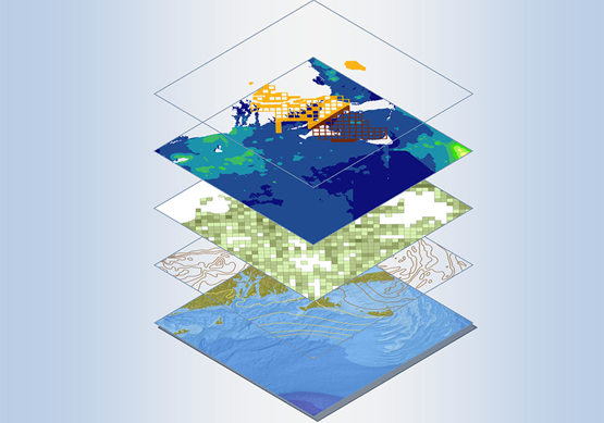
Geographic information system (GIS) mapping

Maps – A centuries-old essential tool that has played a crucial role in shaping the civilisation. It is because of maps that we could develop, construct and locate. Today, we have technologically revolutionised every possible element of our lifestyle, but why is it that every time the word “Maps” pops into our heads, our imagination is drawn towards the atlas from school or the paper scroll of a roadmap?

Maps have been paving the way for evolution for aeons. But thanks to innovation, we have moved from paper to screens!

And when you can get access to real-time mapping facilities for any corner of Earth from anywhere, why would you depend on a static dated map? Geographical dimensions keep changing, and thus, it would be smarter to adapt and switch to a more efficient mapping technology - GIS Mapping.

What is GIS mapping?

GIS is the acronym for Geographical Information System. It is a software/system that captures, manages and analyses real-time geographical information. The framework of this tool is designed in a way that it uses the data attached to a unique geographical location. The de-layered information tied to specific geographical points is integrated into its database to deliver customisable, descriptive and hidden geographical patterns which one wouldn’t find on a paper map.

A GIS mapping service allows you to visualise and identify patterns across a wide range of data sets. One can you GIS mapping services referenced to any latitude or longitude. A GIS tool is highly beneficial for the Government, Businesses and Healthcare professionals to track details about customers and their demographics, agriculture, competitors, environment, accidents, and so much more. A GIS mapping service helps in decision making and reduces operational costs by bringing real-time information at speed. Moreover, since the GIS facility also enables data recording, it enhances communication as well.

3D Pointshot is a leading and trusted professional surveying firm, specialising as a GIS mapping service provider in India, along with a basket of other quality products and services. With our data capturing tools, we also provide two drone instruments which are critical for acquiring data for surveying and mapping. These two tools are none other than LiDAR Drone and Photogrammetry Drone, which help professionals have a detailed understanding of areas which are otherwise difficult to access or understand on a map.

  • LiDAR Drone:
  • LiDAR stands for “Light Detection and Ranging”. Similar to a sonar or radar, which use sound and radio waves to measure distances, this drone measures distances by sending laser pulses over the survey sites or a particular point (tree, cliff face, terrain) and then calculates the reflected light pulses with a LiDAR Sensor. It is used to map and detect objects. LiDAR sensors can be used on tripods, drones, automobiles and planes.

    • Photogrammetry Drone:
    • Unlike LiDAR, which uses light as a measuring tool, a photogrammetry drone uses several high-resolution images of an area. Then these images are processed to create realistic and accurate 2D and 3D maps and models. The reconstructed 3D model contains not only elevated/heightened information but also delivers in-depth data about the colour, texture and shape of every point surveyed on the map. A Photogrammetry drone eases the hassles of data interpretation.


    Both the above drones provide excellent efficiency, flexibility and cost-effective data acquisition for agricultural, land management projects and construction sites.

    Let’s further understand how our GIS product can help various industries:

    GIS mapping application:

    • Urban Planning:
    • Finding an empty plot of land is easy, but planning to build a city is a challenge. There are many factors to consider, such as the quality of life of residents and the impact of construction on the environment and the natural habitat. Thus, a GIS mapping service not only helps discover empty regional and local locations suitable for development, but its mapping facility will provide a planner for the sustainable building of structures, bridges, roads, etc. It also suggests accommodation alternatives for when the city multiplies, while limiting damage.

    • Transportation:
    • The transportation industry heavily relies on GIS to draw up and analyse data for optimising road and rail networks, planning new routes based on traffic volumes, identifying accident locations and enabling emergency services, gauging traffic schedules, and understanding traffic and travel behaviour.

    • Government:
    • A GIS mapping service is of utmost importance and the most actively used tool by the Government. It helps law enforcement agencies in city planning, highway planning, mapping, land searches, utility stores, infrastructure development, and tracking crimes, fires and accidents. The GIS mapping tool is used to make informed decisions for the safety of the citizens.

    • Banking:
    • While considering opening a branch at a new location, Banks consider factors like crime statistics, prospective client base, and competitors near or in a specific area. All this information is derived and analysed with the help of a GIS mapping tool.

    • Environment:
    • Organisations which require environmental information about the land, water sources, forests, soil and any other natural sources or aspects rely on GIS mapping tool. This tool indicates the impact of the activities by engineers on the environment and can also forecast natural disasters.

    • Healthcare:
    • A GIS mapping service helps analyse key health trends and map disease cases, the site of origin and the highest affected areas.

    • Telecom:
    • The GIS software helps companies with data for population density, demographics, average earning income, interest and purchasing power, service accessibility, etc. to establish the best possible cell site for their businesses.

    • Market Intelligence:
    • Details about the store, inventory, sales planning, retail store optimisation and marketing are based on consumer behaviour and demographics. A GIS tool helps accumulate such data for companies.

    3D Pointshot – the leading GIS mapping service provider

    With our GIS software, you can expect:

    • Hassle-free user interface
    • Quality-tested application
    • Cost-effective mapping solution

    Whichever industry you belong to, our top-notch GIS tool will not disappoint you. Call us today for further details.