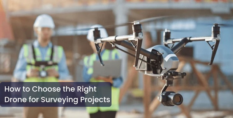
How to Choose the Right Drone for Surveying Projects
- 18 Jul 2025
Drones used for surveys have transformed the application of information in land surveying, construction, farming, and infrastructure planning. The right drone for the survey methodology is imperative for getting substantial outcomes, shorter project duration, and better efficiency. If planned correctly, drone aerial site surveys can be more efficient, safer, and cheaper than historical site surveying methods.
The following items and considerations will be useful when selecting your drone for use in drone surveying and mapping assignments.
1. Define Your Project Needs
Before purchasing a drone, outlining the requirements of your project is important. Are you interested in surveying large, open spaces or smaller, urbanized areas? Are you going to need 2D mapping, 3D modeling, or a combination of both? Determining what size area needs to be covered, resolution requirements, and the terrain type (flat or hilly) will inform whether a fixed-wing drone (for breadth) or multirotor drone (for accuracy and vertical) is best.
Key Tip:
> Fixed-wing drones: Best for large land surveys and agricultural mapping.
> Multirotor Drones: They are most applicable for construction sites, mines, or urban environments with additional structures in the surrounding area. (One example is large construction sites where the land obstructs views and even GPS signals).
2. Camera and sensor capabilities
High-resolution cameras and sensors are the keys to a successful drone survey service. Look for drones that have:
> RGB cameras for photogrammetry.
> LiDAR sensors for topographic surveys.
> Thermal cameras for inspections.
Some drones have interchangeable payloads, increasing flexibility and return on investment (ROI) over time.
3. Accuracy and GPS functionality
Surveying tasks need a high level of precision. Drones with RTK (Real-Time Kinematic) or PPK (Post-Processing Kinematic) GPS attachments provide centimeter accuracy and reduce the required number of ground control points (GCP) to obtain a reliable drone surveying and mapping dataset.
4. Flying Time and Area Coverage
Flying time influences how much area can be covered in a single flight. The best drone for surveying and mapping will have long flight times. Drones that can have a flight time of 30 minutes or more would be especially advantageous for large project sites. An operator can collect more data in a shorter time with a drone that can fly for 30 minutes or more and, as a result, contribute to productivity gains by eliminating downtime.
5. User Friendliness and Application Support
A drone is only as useful as the software that is used to integrate with it. Select a drone that allows you to integrate with industry-leading survey software for mission planning, flight control, and data processing. User-friendly applications with automation capabilities, such as waypoint navigation or auto return, contribute to efficiency and simpler processes, particularly when using an unmanned aircraft for a site survey purpose.
6. Customer Support and Training
It is important to think about customer support, training, and warranty, so please don't overlook that! A professional drone survey company will provide technical support, spare parts, and hands-on training to make sure your team can use the equipment effectively.
Conclusion
Selecting the right drone can improve the quality, speed, and precision of your surveying projects. Whether the work includes mapping agricultural land, construction projects, or mining, using the best drone for surveying and mapping is essential for success.
3D Pointshot provides the same expert drone survey services using cutting-edge UAV technology that are personalized to your project requirements. Our team is prepared to help you select your next drone survey project.
Contact us today to soar with your surveying advancements.