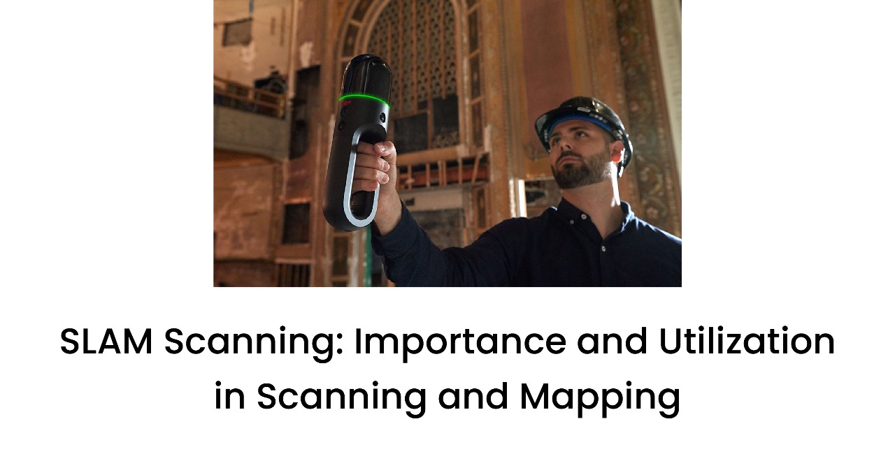
SLAM Scanning: Importance and Utilization in Scanning and Mapping
- 12 Aug 2022
The SLAM Laser Scanner
All the information you require regarding cutting-edge technology.
SLAM has completely changed the playing field for anyone who is interested in mapping their environment. However, what precisely is this technology, how does it operate, and which SLAM is best for you?
SLAM: What is it?
Simultaneous Localization and Mapping, or SLAM is sometimes also called synchronised localisation and mapping. It involves mapping a location while keeping track of the device's location within that location. Mobile mapping is made possible because of this. Because areas may be measured using mobile robots, drones, or vehicles, enormous areas can be mapped in much less time. SLAM Laser Scanner makes data collecting easier and can be applied both indoors and outdoors.
Simultaneous Localization and Mapping is simply the mapping of an unknowable environment by means of sophisticated algorithms.
SLAM LiDAR scanner is used to simultaneously localise (find itself on a map) and map (generate a virtual map of the location).
Using SLAM scanning, Sensors may employ basic positional data from an inertial measurement unit, non-visible data sources, or visual data (IMU).
The device calculates a "best estimate" of where it is using the sensor data. Every few seconds, fresh positional data is gathered; when this happens, features align and the estimate gets better.
SLAM's origins can be traced to the robotics sector in the 1980s and 1990s.
SLAM technology is being utilised by numerous sectors. Opportunities to better map and comprehend surroundings, whether they are indoor, outdoor, in the air, or subterranean, have actually increased.
SLAM LiDAR scanner: What is it?
A laser sensor is used by a LiDAR-based SLAM system to create a 3D map of its surroundings. By lighting the object with an active laser "pulse," LiDAR (Light Detection and Ranging) calculates the distance to an object (such as a wall or chair leg).
SLAM LiDAR Scanner may be employed in a variety of settings and scenarios and is both quick and accurate.
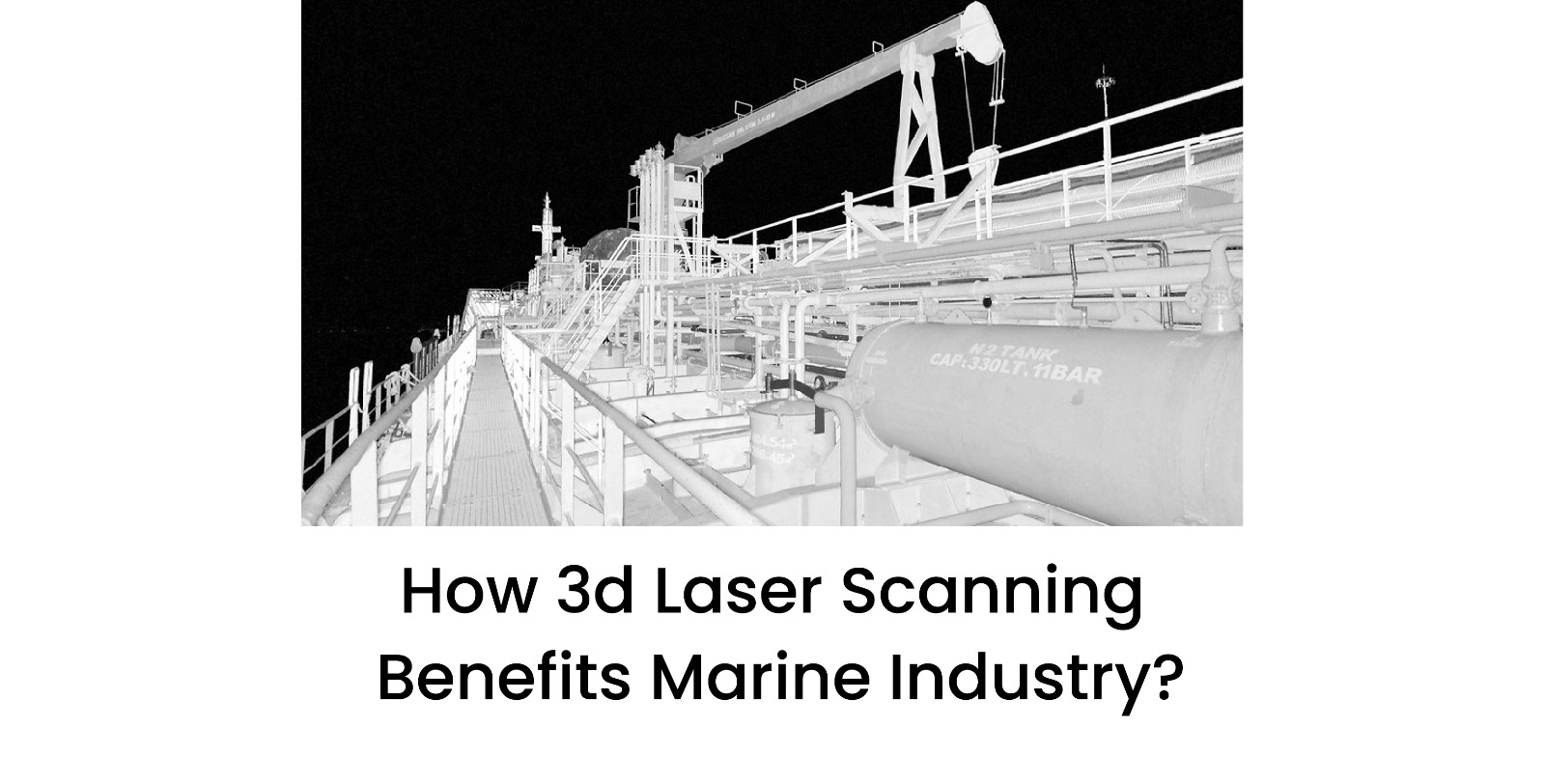
This technique produces a very accurate laser sensor point cloud that is perfect for mapping in the building industry. There are a variety of potential uses for these highly accurate distance measurements.
How have SLAM SCANNING evolved maps?
SLAM Scanning is a major game-changer for anybody involved in the gathering of geospatial data. The days of several, stationary setups of large, tripod-based systems are long gone.
Go-anywhere mapping allows you to quickly and easily navigate through a space while creating a digital map along the way.
SLAM can even be used to map uncharted environments, allowing us to better understand the ecosystem we live in.
What advantages does SLAM 3D Scanner have?
Systems based on SLAM Scanning are inherently mobile and perform best when employed in a mobile environment. The days of having numerous static setups of large tripod-based systems are long gone. With a SLAM mobile mapping system, you can just walk through an environment while creating a digital map, saving time and money by eliminating the need for time-consuming set-ups. Mobile mapping systems based on SLAM reduce survey times and can acquire data up to ten times more quickly.
Additionally, GPS is ineffective indoors since it needs a line of sight to at least three satellites to operate. However, GPS-based solutions are also ineffective outside. Forests present challenges because tree canopies obstruct the line of sight to the sky, and built-up areas such as canyons or towering buildings can also interfere with signals. These challenges are overcome by SLAM 3D Scanner based technology by completely eliminating GPS. SLAM Laser Scanner makes scanning of intricate and constrained areas possible, whether by hand or by mounting a scanner to a cart, drone, or pole. This makes it possible to survey a huge range of previously very difficult, time-consuming, or both situations.
This creates a lot of options for the built environment because SLAM 3D Scanner can assist builders in quickly and precisely creating 3D models while also assisting them with:
- Monitoring of construction sites' quick, weekly progress
- Instantaneous inspections of residential, commercial, and industrial buildings
- Thorough site inspections of buildings that need to be renovated, expanded, or remodelled.
It is simple to understand why the survey industry views SLAM mapping tools as a "disruptive technology."
What type of SLAM Scanning is best for you?
A SLAM LiDAR Scanner would produce the greatest results if you wanted to make a very accurate 3D map of an underground mine, within a building, or from a UAV. However, Visual SLAM may be chosen if you need SLAM for computer vision (AR) or unmanned robots.
Conclusion
Synchronised Localisation and Mapping (SLAM) has become an important tool. SLAM is a sophisticated technique for producing 3D scans in an area without access to a GPS signal. In addition to using sensors to build a 3D model of the environment, SLAM algorithms use sensor fusion to pinpoint their location within a space or asset. By combining localization with mapping, on-the-go scanning is made possible, reducing the need for much of the pre-planning involved with conventional stationary approaches. SLAM Scanning Services by 3D Pointshot will give you the best results at a very affordable cost.